TASK ···· · SPOTLIGHT SAT: ··· θ = ···° ○ SEARCHING
SPOTLIGHT · θ = ···° · SEARCHING

Pavan Muguda
Sanjeevamurthy

SAR data scientist · Earth observation researcher
24.4539° N, 54.3773° E  ·  ALT: 27 m  ·  PASS: ASCENDING

I turn radar measurements into evidence about a changing Earth: from deformation and soil moisture to operational intelligence at continental scale.

◎ AOI
SCROLL
Pavan Muguda Sanjeevamurthy
4+
Yrs Research
2
Journal Papers
10
Conferences
4
Open Source Tools
About Me

I'm a Remote Sensing Data Scientist at Space42 in Abu Dhabi and a PhD researcher at TU Wien, Department of Geodesy and Geoinformation. I hold a Master's in Earth Oriented Space Science & Technology (ESPACE) from TU Munich with specialisation in Remote Sensing.

My work spans the full SAR processing chain — from raw SLC co-registration and InSAR deformation monitoring to operational Copernicus soil moisture products fusing Sentinel-1 and ASCAT at sub-kilometre resolution.

Previously at DLR (German Aerospace Center), TU Munich, and Universität der Bundeswehr München, always at the intersection of radar signal processing, deep learning, and geospatial intelligence.

Expertise

Skills & Tools

Programming
Python MATLAB IDL Julia C Bash
Radar Data Experience
Sentinel-1 SAR ICEYE SAR Capella SAR MetOp ASCAT
Radar Processing Software
ESA SNAP PyGMTSAR MintPy
SAR & InSAR Methods
Backscatter Analysis Interferometry SBAS InSAR PSInSAR
GIS & Spatial Analysis
Google Earth Engine ArcGIS QGIS
EO Data Engineering
xarray rioxarray GeoPandas Dask GDAL pyproj
ML & Deep Learning
PyTorch segmentation_models ClearML scikit-learn U-Net Self-Supervised
DevOps & Infra
Linux Docker Git GitLab CI/CD HPC (SLURM)
Career

Professional Experience

S42
Oct 2025 — Present
Data Scientist – Remote Sensing
Space42
Abu Dhabi, UAE
TUW
Oct 2022 — Sep 2025
Project Assistant
Technische Universität Wien (TUW) · Geodesy & Geoinformation
Vienna, Austria
UBW
Aug 2022 — Nov 2022
Research Assistant
Universität der Bundeswehr München
Munich, Germany
TUM
Nov 2021 — Jun 2022
Master Thesis + Student Research Asst.
Technische Universität München (TUM)
Munich, Germany
DLR
Apr 2020 — Sep 2021
Student Asst. – SAR Signal Processing
German Aerospace Center (DLR)
Oberpfaffenhofen, Germany
CAE
Sep 2018 — Aug 2019
CAE Automation Engineer
BETA CAE Systems
Bangalore, India
RRI
Jun 2017 — Mar 2018
Visiting Student Researcher
Raman Research Institute
Bangalore, India
Academic Background

Education

PhD
PhD in Remote Sensing
Dept. of Geodesy and Geoinformation
Technische Universität Wien
Vienna, Austria  ·  Oct 2022 – Present
Ongoing
MSc
M.Sc. Earth Oriented Space Science & Technology
ESPACE · Specialisation: Remote Sensing
Technische Universität München
Munich, Germany  ·  Oct 2019 – May 2022
Aerospace Geodesy
B.E.
B.E. in Mechanical Engineering
Engineering Sciences
Nitte Meenakshi Institute of Technology
Bengaluru, India  ·  Jun 2013 – Apr 2017
Work

Featured Projects

SCATSAR Soil Water Index Pipeline (Copernicus)
Near-real-time fusion of Sentinel-1 SAR and ASCAT surface soil moisture for Copernicus CGLOPS. Produces Soil Water Index at 0.5 km resolution across Europe using recursive exponential filter formulations.
PythonSentinel-1 ASCATNRT PipelineCopernicus
InSAR Denoising via Self-Supervised Learning
Complex-valued U-Net with non-local attention blocks for InSAR phase denoising. Includes SAR interferogram simulation pipelines and benchmarking against state-of-the-art filters on real Sentinel-1 data.
PyTorchInSAR Self-SupervisedU-NetSentinel-1
Drought Monitoring – ASCAT over East Africa
Operational drought indicator workflow for MetOp ASCAT SSM at 6.25 km, covering both climate data records and near-real-time applications for humanitarian early warning over East Africa (ROSSIHNI project).
ASCATPython DroughtEast AfricaH SAF
Open Source

Open-source Tools

LIVE
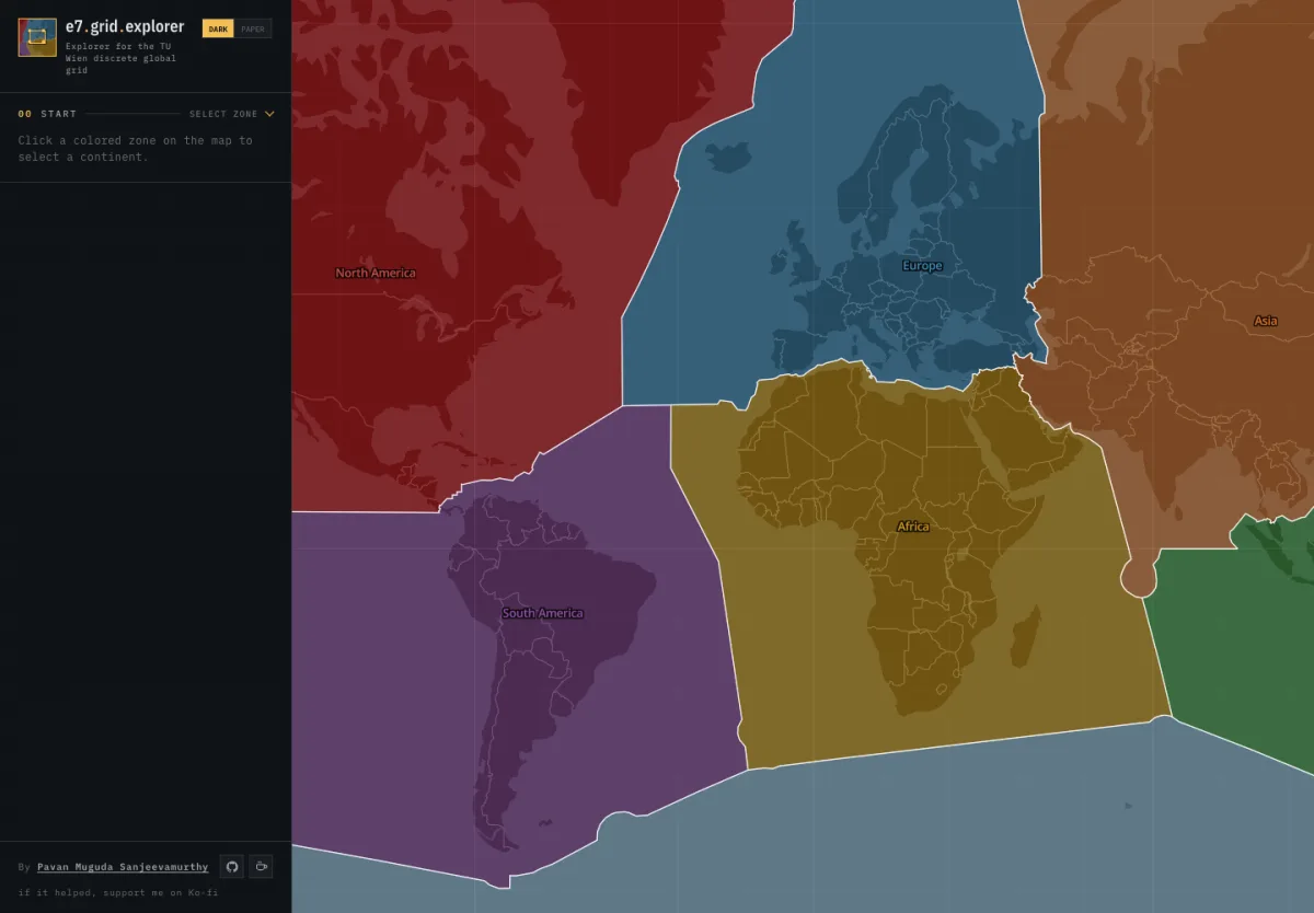
Equi7Grid Explorer
Interactive explorer for the discrete global grid system developed at TU Wien. Visualise continental regions and intersect tiles at 600 / 300 / 100 km resolutions with any custom area of interest.
Launch tool  →
LIVE
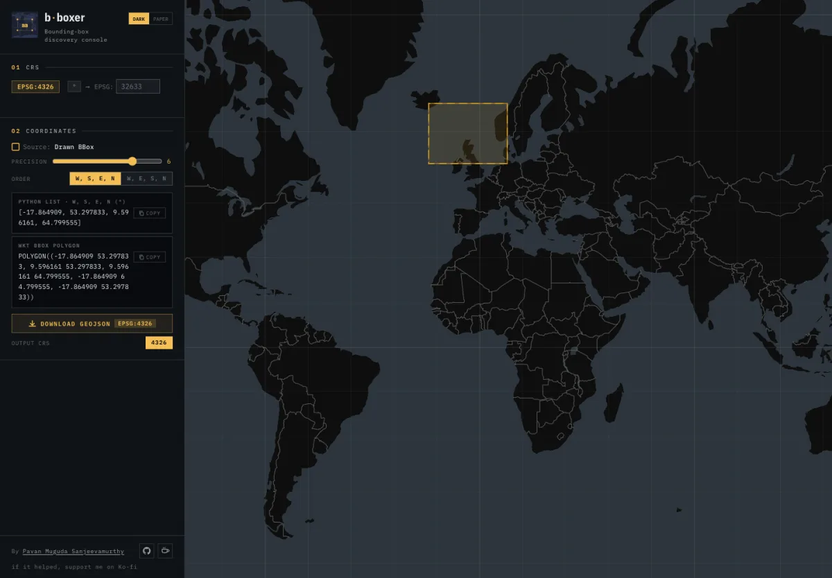
BBoxer
Draw a bounding box on an interactive map and instantly export the coordinates in multiple formats, ready to drop into your geospatial workflows and area-of-interest queries.
Launch tool  →
LIVE
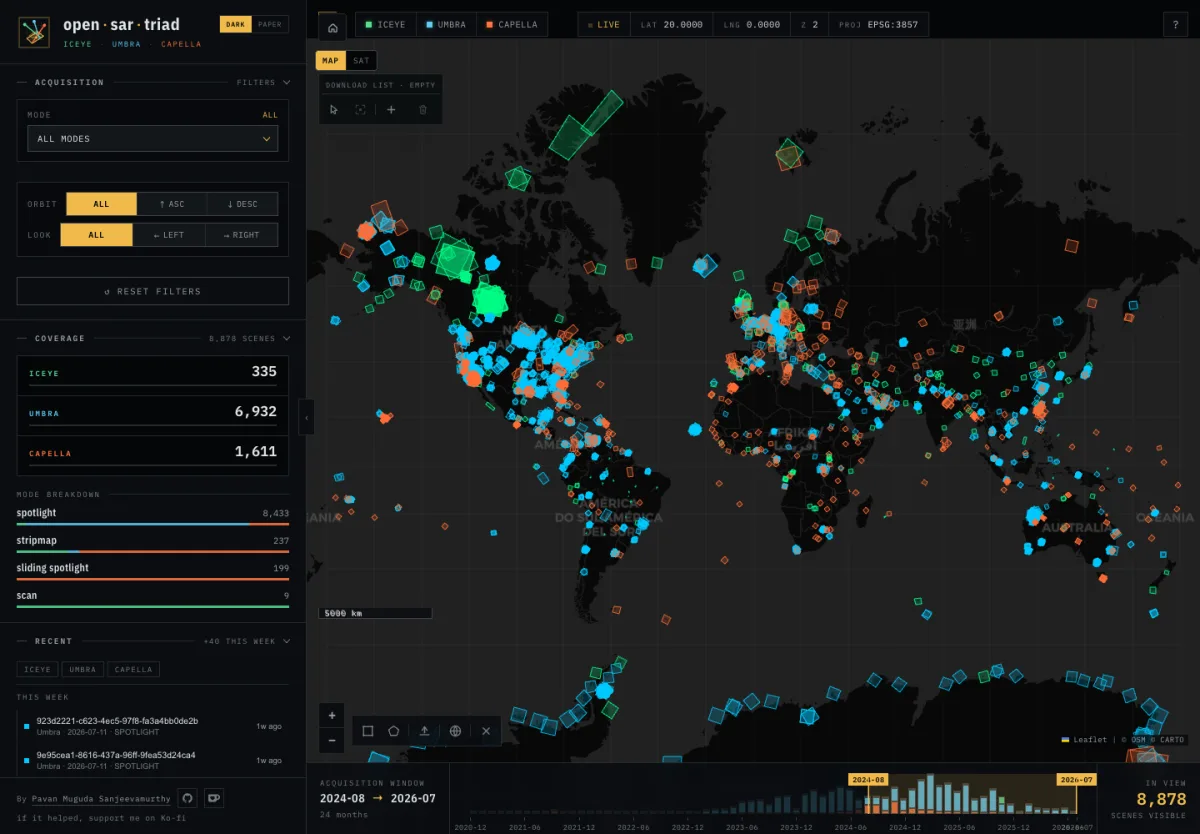
Open SAR Triad
Explore publicly available SAR scenes from ICEYE, Umbra, and Capella on an interactive map. Filter by provider, date range, sensor mode, and area of interest with scene thumbnails, metadata, download links, and STAC export. Data refreshed weekly via GitHub Actions.
Launch tool  →
LIVE
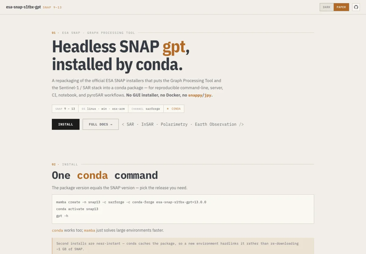
ESA SNAP GPT for Conda
Headless ESA SNAP Graph Processing Tool with the Sentinel-1 and SAR stack, packaged for reproducible conda environments. Built for command-line, server, CI, notebook, and pyroSAR workflows without a GUI installer or Docker.
View package  →
Research Output

Publications & Research

2026 Under Review IEEE Journal of Selected Topics in Applied Earth Observations and Remote Sensing (JSTARS)
Analysis of the New 6.25 km ASCAT Soil Moisture Data Record for Improved Anomaly Detection over Eastern Africa
Muguda Sanjeevamurthy, P.; Vreugdenhil, M.; Hahn, S.; Massart, S.; Wagner, W.
2025 Journal Agricultural Water Management, 318, 109638
High-resolution Drought Monitoring with Sentinel-1 and ASCAT: A Case-study over Mozambique
Massart, S.; Vreugdenhil, M.; Borguete, R.R.; Villegas-Lituma, C.; Hahn, S.; Muguda Sanjeevamurthy, P.; Wagner, W.
2026 ISPRS Annals of Photogrammetry, Remote Sensing and Spatial Information Sciences
Analyzing the Potential of ASCAT Surface Soil Moisture 6.25 km for Drought Monitoring over Mexico
Vázquez Rodríguez, D.A.; Muguda Sanjeevamurthy, P.; Wagner, W.; Hahn, S.; et al.
2025 EGU General Assembly — EGU25-20319
Observing Changes of India's Summer Monsoon
Vreugdenhil, M.; Roebling, R.; Sanjeevamurthy, P.; Hahn, S.; Wagner, W.
2025 Living Planet Symposium — ESA
H SAF ASCAT Disaggregated Surface Soil Moisture at 0.5 km: First Validation Results with ISMN Data Over Europe
Muguda Sanjeevamurthy, P.; Hahn, S.; Vreugdenhil, M.; Raml, B.; Wagner, W.
Show 7 more
2024 EGU General Assembly — EGU24-6782
A Case Study on Agricultural Drought Monitoring using ASCAT Surface Soil Moisture at 6.25 km over Eastern Africa
Muguda Sanjeevamurthy, P.; Vreugdenhil, M.; Hahn, S.; Massart, S.; Villegas-Lituma, C.; Lindorfer, R.; Wagner, W.
2024 EGU General Assembly 2024
Drought Monitoring and Early Warning with Satellite Soil Moisture Data
Vreugdenhil, M.; Massart, S.; Muguda Sanjeevamurthy, P.; Villegas-Lituma, C.; Enenkel, M.; Wagner, W.
2024 EGU General Assembly 2024
Sensitivity of Sentinel-1 Backscatter Signal to Vegetation Dynamics over Mozambique: A Comparison with MODIS Data
Villegas-Lituma, C.; Vreugdenhil, M.; Massart, S.; Muguda Sanjeevamurthy, P.; Raml, B.; Wagner, W.
2024 EGU General Assembly 2024
High-resolution Drought Monitoring with Sentinel-1: A Case-study over Mozambique
Massart, S.; Vreugdenhil, M.; Hahn, S.; Muguda Sanjeevamurthy, P.; Villegas-Lituma, C.; Wagner, W.
2023 IGARSS 2023 — IEEE GRSS
Self-Supervised Learning for InSAR Phase and Coherence Estimation
Sica, F.; Muguda Sanjeevamurthy, P.; Schmitt, M.
2023 EGU General Assembly — EGU23-7441
Improving 1 km Sentinel-1 Soil Moisture Retrievals by Optimizing Backscatter Preprocessing Workflows
Wagner, W.; Massart, S.; Raml, B.; Quast, R.; Muguda Sanjeevamurthy, P.; Navacchi, C.; Reuß, F.; Bauer-Marschallinger, B.; Vreugdenhil, M.
2023 EGU General Assembly — EGU23-16205
MetOp ASCAT Soil Moisture Trends: Mitigating the Effects of Long-term Land Cover Changes
Hahn, S.; Wagner, W.; Alves, O.; Muguda Sanjeevamurthy, P.; Vreugdenhil, M.; Melzer, T.
Media Coverage

In the News

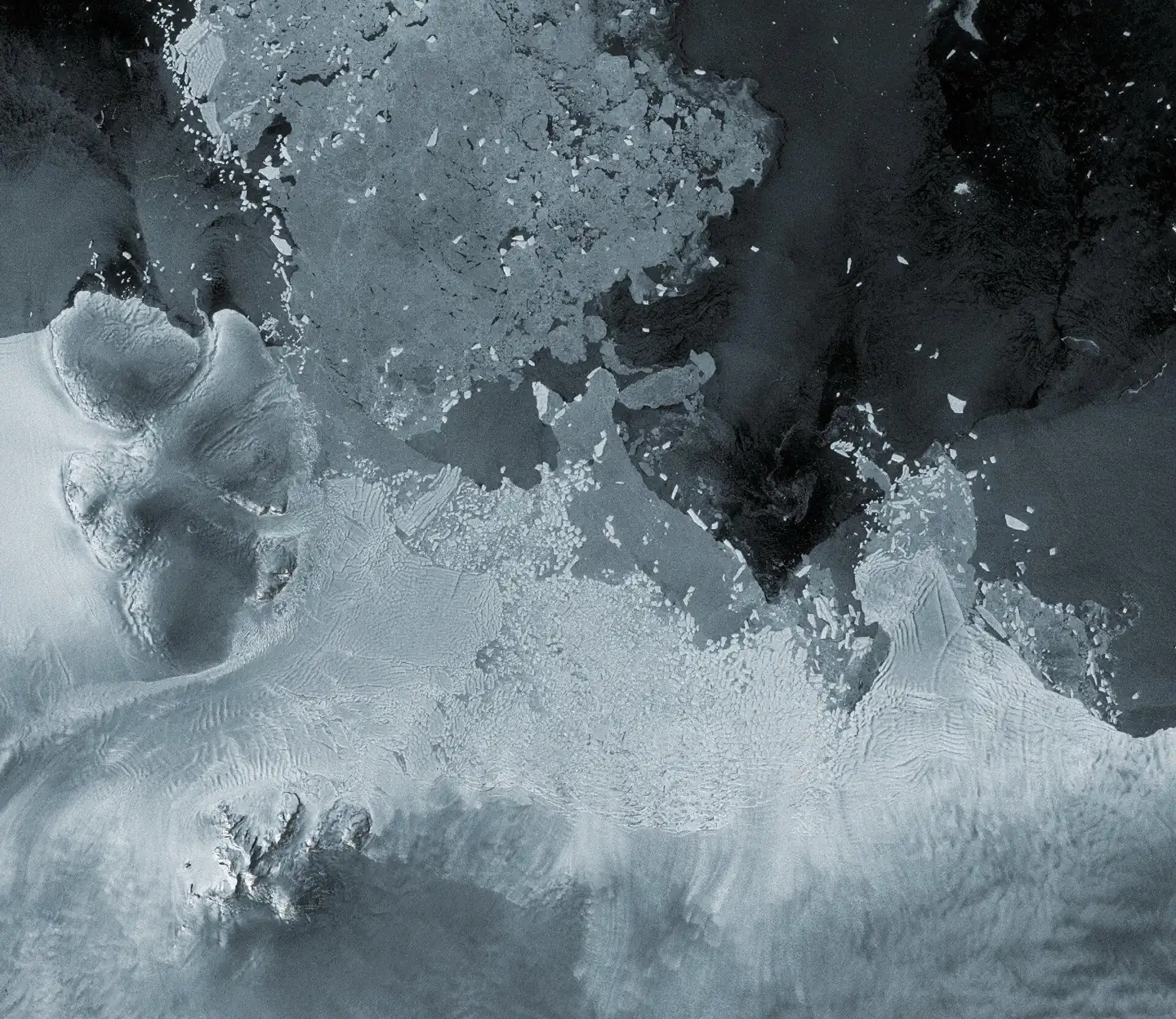
Indian monsoon trends satellite data
EUMETSAT  ·  September 2024
More intense Indian summer monsoons
Satellite data from 1991 to 2020 reveal heavier summer rainfall that is likely to continue. Analysis shows daily rainfall increased by 0.1 mm per decade across India, driven by accelerating temperature contrasts between the warming Himalayas and the Indian Ocean.
Contributor: Pavan Muguda Sanjeevamurthy  ·  H SAF / TU Wien
Read on EUMETSAT  →
Recognition

Honours & Awards

Deutschlandstipendium Scholarship
Federal Government of Germany  ·  Oct 2019 – Sep 2020
Merit-based national scholarship awarded by the Federal Government of Germany for academic excellence, supporting studies at Technical University of Munich.
Get In Touch

Let's Connect

Open to research collaborations, SAR & InSAR discussions, and geospatial intelligence projects.

CAREER GROUND TRACK  ·  BLR 2013 → MUC 2019 → VIE 2022 → AUH 2025